Watch on YouTube
(Embed)
1,916
65
Genre: Science & Technology
License: Creative Commons Attribution license (reuse allowed)
Family friendly? Yes

Shared January 22, 2026
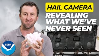
Ice storms can knock out power, damage roads, and create dangerous travel conditions. But it’s hard to track where freezing rain is falling and how much ice is building up in real time.
That’s why NOAA researchers created FRANA — the Freezing Rain Accumulation National Analysis. It combines radar and surface data to show where ice is falling and how much is accumulating as a storm happens. The National Weather Service is already using this data to help improve forecasts and keep communities safer.
Learn more at www.nssl.noaa.gov/
————————————
Follow Us On
————————————
Facebook: www.facebook.com/NOAA.NSSL
Twitter: twitter.com/NOAANSSL
Flickr: www.flickr.com/photos/noaanssl/
Instagram: www.instagram.com/noaanssl/
More videos from NOAA Weather Partners: youtube.com/user/NOAAWP


2.7M views

1 Minute Ago: Carney Walks Out Did Trump Just Trigger a North American Economic Crisis | George Will
351K views